Concrete Shields and Buried Tunnels: What Satellite Imagery Reveals About Iran's Military Posture
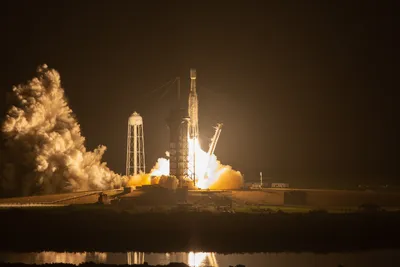
Recent commercial satellite imagery has captured Iranian military construction activities at multiple sensitive sites, offering rare transparency into Tehran's defensive preparations amid escalating tensions with the United States and Israel. The photos document concrete fortifications built over newly constructed facilities, soil coverage at nuclear sites previously targeted, and repairs to missile infrastructure damaged during last year's military conflict—all visible from orbit and all speaking to a nation preparing for possible further strikes.
The imagery shows Iran constructing protective concrete shields at a military facility reportedly struck by Israel in 2024, then deliberately covering the structure with soil. Simultaneously, satellite data reveals buried tunnel entrances at nuclear sites previously damaged by US ordnance during Israel's 12-day military campaign against Iran in 2025, along with reinforced fortifications at nearby installations. These aren't accidental observations—they're deliberate construction projects documented across multiple locations, suggesting a coordinated, nationwide hardening effort.
The Escalation Spiral: Military Buildup Meets Nuclear Negotiations
This defensive activity unfolds against a backdrop of aggressive diplomatic pressure and military positioning. President Trump has repeatedly suggested potential US military strikes against Iran via his Truth Social platform, while the White House simultaneously demands Tehran "make a deal" on its nuclear program. The contradiction isn't accidental—it's leverage, applied at maximum pressure.
Washington's military posture backs up the rhetoric. The US currently maintains 13 warships in the Middle East, including the aircraft carrier USS Abraham Lincoln leading a full strike group, nine destroyers, and three littoral combat ships, with additional vessels en route. This represents one of the most significant naval concentrations in the region in recent years, capable of sustained power projection and immediate strike capability against multiple targets across Iran's lengthy coastline and inland military infrastructure.
The dynamic mirrors Cold War nuclear brinksmanship—both sides signaling military readiness while negotiations theoretically remain possible. Iran's satellite-visible fortification work is a public message: we're preparing for war, but we're also still here. The US naval buildup delivers its own message: we have the capability to act on our threats.
Why Satellite Imagery Matters in Modern Conflict
Commercial satellite imagery has become a critical intelligence source—not classified, not contested, simply observable fact that both sides know exists. When Iran visibly reinforces tunnel entrances or builds protective structures, analysts worldwide can verify the activity in near-real-time. This transparency paradoxically increases pressure: everyone knows everyone else's preparations, raising the stakes and the risk of miscalculation.
The specific locations targeted for fortification—nuclear sites and missile bases—indicate Iran's assessment of its most vulnerable infrastructure. The visible hardening of these facilities suggests Tehran believes either continued US strikes are likely or that demonstrating resilience strengthens its negotiating position, or both.
What's Next: The Negotiation-or-Confrontation Timeline
The immediate question is whether this military posturing supports nuclear negotiations or replaces them. Historical precedent suggests both sides use military displays to strengthen bargaining positions, but the current rhetoric from Trump administration officials—especially Leavitt's statement that Iran "would be very wise to make a deal"—carries an implicit threat. How Iran responds to this combination of military pressure and diplomatic demand will likely determine whether 2026 sees armed conflict or a negotiated settlement. Satellite imagery will continue documenting the answer.